Showing posts with label light rail. Show all posts

Sunday, June 14, 2015

Tunnel Visions: The Docklands Light Railway

Every once in a while I hop out of Toronto, land in some other city with some other light- or heavy-rail transit system, and look around at different ways of getting around by rail, whether it's on the ground, under it, or above it all.


London! Home to the mother of metros, the sprawling London Underground, opened in 1863 and connecting the core of the Square Mile with the commuter fringes of Metro-land, and you can't seriously believe I was going to do one of these things about the Underground, can you? Entire books can be, and have been, written about the Underground. Books can be written out individual lines of the Underground, lines which are more complicated and cover more ground than entire systems that have previously appeared in Tunnel Visions. Maybe if I spent a couple of years living in London and using the Tube every day, things would be a bit different, but today it's just not on. I mean, come on. This is the first time I've got out of North America for this. Baby steps.

What's far more manageable on a sightseer's budget is the Docklands Light Railway--a network which you could easily miss, even as a transit fan touching down in the capital. It doesn't have the history or the character of the Tube, for sure, and it's not well-known enough to show up in blockbuster movies even when it would make sense to in the narrative--I'm looking at you, Thor: The Dark World--but it is small enough to hold a picture of in one's head, and concise enough for an outlander to get at least an impression of in the course of a week and a half.

That's small in the context of London, of course. What you've got to remember is that London is gargantuan. The DLR... the DLR is less so.

System

Two DLR trains pass over the waters of Middle Dock in Canary Wharf, above the skyscrapers of the City of London.

As its name suggests, the Docklands Light Railway was built to serve the Docklands region in the East End, and not Heathrow Airport. It started running in 1987, when the light rail renaissance saw rails being laid across Europe and even bits of North America, and when the Docklands were still transitioning from being, y'know, docks. Today it reaches across the London Borough of Tower Hamlets and beyond, linking Greenwich and Beckton to London City Airport and the claustrophobic, sweaty subterranean hell that is the Bank-Monument station complex. My friends mocked me about it and my desperation to use alternate routes between platforms after the incident, but that's exactly what it is. Come on, tell me I'm wrong.

By the early 1990s the DLR remained fairly limited, with lines connecting Tower Gateway to Island Gardens at the southern end of the Isle of Dogs and from there to Stratford in the north--though even then, the underground connection to Bank and the eastern extension to Beckton were under construction, as was the station at Canary Wharf. It wasn't until 1999 that it was taken south of the Thames through Greenwich to Lewisham, and it hopped the river again ten years later as part of an extention to Woolwich Arsenal. Today, the system touches on wide areas of East London beyond those pockets served by the Tube or the new Overground, and is big enough that it could be dropped down into a North American city on its own and be one of the continent's larger networks. There are plenty of cities over here that would love to have something like the DLR.

In London, though, it's just another part of the patchwork transit that shuffles people across the capital like so many things that are shuffled. Hell, Mark Mason--who's famous to me for performing the not-entirely-sane act of walking the extent of the London Underground on foot--doesn't even think it should be considered part of the same system, and he's not wrong. From the technology it uses to the nature of the route, the DLR feels more like some other city's transit system grafted onto London after some marathon urban surgery session. Considering that that feeling holds clear today, almost a year after I first stepped foot on the thing, I'd say there's a firm point to it. Nevertheless, there is noticeable overlap between the DLR and the Underground--automated announcements, for instance, are shared between them, such as the one that often reminds riders to keep their Oyster contactless payment cards separate from others to avoid card clash. Worthwhile advice, incidentally, as I discovered that my Presto contactless payment card did, in fact, cause card clash.

The future will see it tied more tightly into the transit knots that bind the capital together, though. Construction on Crossrail, the mammoth fifteen-billion-pound project that will route even more suburban trains through London from 2018, is advanced enough that I could see the grand shell of the future station at Canary Wharf and the works underway at Custom House and the portal near Canning Town--connections that will further open up east London. Though I don't imagine many tourists will end up that way regardless. For me, my explorations of the DLR made me wonder when someone would take note of my accent and ask what the hell I was doing out there.


Stations

A late-evening DLR train waits beneath the glass roof of Canary Wharf station.

As of this writing, Docklands Light Railway passengers have their choice of forty-five stations to alight at, although Woolwich Arsenal is the odd station out here for being the only one beyond Zone 3 and therefore the only station I never even tried to reach--I mean, come on, if I was going anywhere beyond Zone 3 that wasn't Heathrow, it's be Cockfosters. Of these, seven link up with the Underground--though Canary Wharf's "link" is more theoretical than actual, considering the tales I've heard of people losing their way between one and the other, and the jet-lagged wandering about I had to do before I found it--and other connections enable transfers to the Overground and the Emirates Air Line, because I guess there will always be people who want to see the Millennium Dome from the air without having to get on an airplane. If you're looking for a plane, though, you can pick one out on the London City Airport departures board they've thoughtfully installed at Platform 3 at Canning Town.

There's also substantial integration with mainline National Rail services throughout the system, though I was only to experience it at Lewisham, the terminus of the DLR's branch into Greenwich. When I alighted there, I ran into a tide of people coming from the other end, a veritable Bloor-Yonge transfer's worth of people streaming out of the National Rail station. There were quite a few taxis waiting to pick up fares, but for a suburban transfer station, its commuter parking was surprisingly nonexistent. I come from a Canadian perspective, remember--the suburban stops on Toronto's commuter rail lines feature multi-storey car parks. The only allowance for parking I found nearby was for the Tesco next door, and with a £70 charge for staying longer than three hours, I doubt it's welcoming to commuters. Hell, for that rate you could park in the City, I'd imagine. Though I don't know if there are any parking garages there, between all those old roads with oddly specific names like "Old Jewry" or "Poultry." Not Poultry Road or Poultry Street, mind you--just Poultry.

Given that background, I was gratified to discover that the DLR maintains the English tradition of maintaining odd names that made sense a hundred or a thousand years ago. I mean, it'd never occur to me to name a station "Mudchute," especially existing as it does between calm parkland and undoubtedly super-expensive housing on the Isle of Dogs--but hell, there was a chute there for getting rid of mud during construction a hundred and sixty years ago, and it's not likely to have any competition in the name department any time soon, so why not? Just up the line you'll find Crossharbour, which provided a brief reminder of home, because even disgraced British criminals like Conrad Black need transit stations to lord over, even if he's actually a baron.

One thing that struck me fairly early on about the DLR--in fact, it's the second entry in my notes--is that there are spots where you can easily see one station while in another. Granted, this isn't unheard of outside London, since there are points along Toronto's Bloor-Danforth Line where the lights of the next station are visible in the distance, bright against the tunnel's darkness. But following the pedestrian path through the closely-bounded confines of Millwall Park, Island Gardens Station had only just disappeared behind a bend of foliage when the signs for Mudchute came into view, and East Ferry Road doesn't seem nearly developed enough to sustain a justifiable catchment area for both stations. Aside from a pub advertising cash prizes for trivia night (£1 per person to enroll), it's lined with the sort of brick-solid workmen's homes that have undoubtedly been colonized by professionals who spend their days in Canary Wharf shuffling around other peoples' money.

Appropriately enough, then, Canary Wharf refined the concept beyond anything I was familiar with. From its DLR platforms, the station at West India Quays is clearly visible from Canary Wharf, which itself is clearly visible from Heron Quays, to the extent that the Underground connection at the Jubilee Line applies pretty much equally to Canary Wharf and Heron Quays--staying as I was down by Island Gardens, I frequently found it easier to hike to Heron Quays and be one station closer to alighting.

That is, if you're able to alight at your station at all. It's a good thing that DLR trains allow passengers to pass from one carriage to the next, as on the Toronto Rocket; at Cutty Sark for Maritime Greenwich (a committee-chosen name if ever there was one) and Elverson Road, the standard DLR trains are actually too long for the platforms, requiring automated announcements reminding riders to move to the center of the train to alight, because allowing people to walk off onto, say, the third rail would be a Bad Thing Indeed™. TfL gets around that by keeping the first two and last two doors shut, but if thirty-two years of life has taught me anything, it's that I'm shocked as hell that you don't see people trying to force them open. Maybe it does happen and the news just doesn't cross the Atlantic.


The DLR's Deptford Bridge station, well done up in concrete, stretches across Blackheath Road.

Another thing that struck me about the DLR is how much variety there was in the nature of its stations. Not architecturally, I mean--the oldest is younger than I am, and so many of them are trapped in that late-20th century glass-and-steel style that can't hold a candle to the sort of stuff that Leslie Green designed for the Underground a hundred years ago. No, in this case I just mean the way they interact with the cityscape around them. Take, for example, the terminal stations at Bank and Tower Gateway--the former accessed by a five-minute march (I timed it) from the District Line and Circle Line platforms through cramped and overheated passageways, and the latter accessed by a five-minute walk from Tower Hill station, though to be fair I started my clock from the platform, and most of that time was spent getting out of Tower Hill station. Once all the other tourists peeled off toward the Tower of London, the route to Tower Gateway was bright and open and much preferable, honestly, and from it the DLR sets off comfortably above the London streetscape.

Much of the DLR is elevated, at that. Along the Isle of Dogs, it only meets the ground at Mudchute--where a man who looks like he's just come from the modern office, smartly casual dress with a backpack slung over one shoulder, alights with a Sainsbury's bag weighed down to translucency and hurries away past a sign bearing Boris Johnson's promise that it's only seventeen minutes from there to Bank--and then only to sink underground to Island Gardens and thence to Greenwich; before the extension was tunneled under the river, Mudchute and Island Gardens were both elevated stations. Island Gardens, beyond its vaguely-nautical flair, is a bit of an imposing station if only becuse of what I presume are ventilation shafts for the tunnels--if it ever shows up on an episode of Doctor Who, presumably they'll prove to be disguised planetary defense laser cannons or something. Other stations, like Cutty Sark for Maritime Greenwich, are deep enough underground that there's enough room to put the tunnelling shield they used to build it on display, while ones like the Beckton terminus are at ground level.

Then there are places like Stratford, and though it's no Stratford International it's still a riot of walkways and platforms connecting to the Central Line and Jubilee Line, the London Overground, National Rail, and three distinct branches of the DLR itself. Ten months on, I remember it mostly as "busy." I managed to find the platform for the DLR branch I wanted just after I left, and even then it only ran as far as Canary Wharf. The thirteen-minute wait for the next train was the longest I experienced in London, and is leagues better than most American transit agencies I've ridden with. After I lived through those lucky minutes and headed away, the train passed construction sites, former Olympic venues, well-maintained greens and buildings with letters falling off the sides. There was a gritty industrial feeling to it all, I thought, much like Scarborough as seen from the RT.

As in Scarborough, it can get cold on the DLR's platforms at night. After 11, when the trains have pulled back to every ten minutes, there's plenty of time for bracing winds off the river to blow in.

Equipment

A DLR train picks up new passengers at West India Quay station.

If I could only use one word to describe the Docklands Light Railway, it'd be "automated." Like the SkyTrain in Vancouver and like the future bearing down on us like a shotgun full of robot parts, the DLR's trains drive themselves across the network with no direct human intervention outside of the transit control center. At least, that's how it works as an ideal. In reality, automation is still a fickle, finicky thing, for which everyone can thank their jobs for as long as they still have them.

Like the SkyTrain, DLR trains can be operated by a human when necessary, and on Monday, August 11, 2014 I witnessed a hell of a lot of DLR trains being operated by humans. The previous night, a disabled train at Westferry and a signal delay had halted movement across the entire DLR network, a delay that lasted at least as long as it took me to ride the Tube from Monument to Bow Road and then walk to Bow Church, where I found two trains frozen at their respective platforms with doors wide open. Even when the system wasn't rebounding from a major collapse, I found my path crossing with human staff fairly often, though generally in the form of fare inspectors. I encountered fare inspectors--they may have been the same person, actually, now that I think about it--on the first two trips I ever took on the DLR.

The trains themselves are fairly unremarkable, and if not for the general '80s-retro blockiness of their design and the English accents in the announcements and among the passengers, I could have been back in Vancouver. Presumably owing to London's present cool and rainy climate, there wasn't much air conditioning that I recall encountering along the system, and if you wanted ventilation you cracked a window as if you were on a bus. Their self-driving nature means that passengers can get a good view down the tracks from the front car, but unlike Vancouver, there's no single seat in the middle that makes you feel like the captain of the train.

Still, the rolling stock is small and personal enough that the "Light Railway" part of the DLR's name isn't just an affectation. They're not that much bigger than the new streetcars that have begun to hit Toronto's streets, and which will be the backbone of this city's light railway network if it ever gets off the ground. Still, I don't imagine that many tourists get out to Tower Hamlets, and there are plenty of politicians out there who would be shocked to find that a city as world-renowned as London is willing and able to build light railway networks where they're called for.

Ease of Access and Ease of Use

The way up to Tower Gateway, the original Central London terminus of the DLR.

Once I figured out how to get from Canary Wharf Underground station to Canary Wharf DLR station, things were pretty easy-going from there. The Oyster card is pretty foolproof, and I had plenty of chances to practice on the Underground before I made it to the DLR--hell, the biggest issue I encountered was that DLR stations lack turnstiles, and so there'd constantly be the little voice in the back of my head trying to convince me that I'd forgotten to tap my Oyster card and that I'd really rue this day. As I recall, the biggest problem with tapping in ended up boiling down to "where is the Oyster card reader"--at Heron Quays, in particular, it seemed like there were only a couple of readers, set down at a detour from the escalators that took passengers up to the hull-shaped platform. I made sure to tap on the way out, as well, even though I was travelling on a 7-day Travelcard and may not have needed to. But that's the way it goes sometimes. If we didn't do things we didn't need to, the world would be a lot less odd.

Likewise, it's easy to get into DLR stations. The elevated ones I visited all had escalators and elevators, and I'm given to understand that that sort of access holds true for the system as a whole--considering it opened in 1987, when people had actually started to give a shit about other people, I'd expect nothing less. The stations themselves change from side-platform to center-platform with little rhyme or reason--Canary Wharf DLR has a Spanish solution setup with six platforms, the first time I'd encountered one--but the platforms are all equipped with LED boards telling you where the next three trains are going from there, and how long it'll be until they leave. Still, access isn't ideal--at some elevated stations, like Westferry, changing from one branch to the other means you have to descend from the station to street level, cross a couple of streets, and then climb back to to the far side platform and hope you haven't missed the train.

As long as you're there, though, you'll be able to make it open for you. DLR trains don't necessarily open all of their doors automatically; instead, like the Phoenix Metro and Toronto's newest streetcars, each set of doors comes with a button that you can press to open them, though a lot of the time you'll be preempted by people alighting through the same doors.

Signage on the DLR is of the same quality that I encountered on the Underground, and it shares the same Johnston font. Also shared are the "Travel Better London" posters, though some were not entirely as applicable--the "Remember to Stay Hydrated" one, for starters, which made far more sense in the context of a poorly-ventilated, standing-room-only Metropolitan or District Line train running through 150-year-old tunnels. It stuck with me for a while until I realized the reason it was giving me so much trouble was because "oughta" and "water" don't rhyme in a Canadian accent.

DLR ticket vending machines at Deptford Bridge station.

Generally speaking--I'd prefer to dispense with the hedging, but I didn't visit them all and I'd rather not rely entirely on fallible memory--DLR stations are equipped with ticket vending machines that allow you to top up your Oyster card by cash, credit, or debit, capable of speaking a panoply of European languages like Polish, French, and Swedish, and they had no problem at all with my North American credit card. Considering the way things are going, though, these may be on the outs in another few years; during my time in London, I kept seeing advertisements and reminders about how riders could use bank cards directly to pay for Tube or DLR fares, without having to first load money onto an Oyster. It's the sort of innovation I'd imagine Toronto picking up in, oh, another forty years or so.

Conclusion
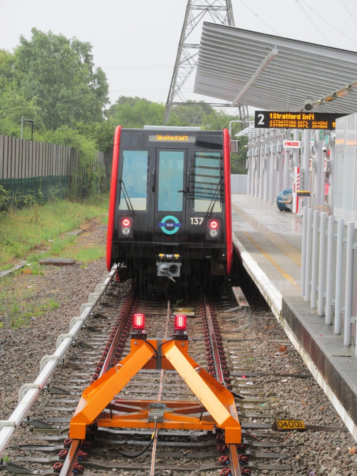
A Stratford-bound train waits to depart from the terminus at Beckton.

This write-up was on unfortunate hold for a while--hell, as I write this, it's been nearly ten months since I took off from Heathrow--but I'm still glad I experienced the DLR and the area of London that it serves. I was there for the World Science Fiction Convention, and if it had been anywhere in London but ExCeL, I doubt I'd have wandered into the DLR's territory, something that's probably true for a great majority of the tourists that visit London. It felt off the track beaten by tourists, beyond the places that everyone says you have to go to when you visit there, and consequentially it felt valid to me, more real--that I was experiencing the city as it is when the knots of foreigners aren't gawking, that I could start to feel the pulse of the capital.

Seeing as how I am a foreigner, it's a bit hollow, I know. I don't claim to understand the DLR--a week's worth of disconnected rambles, generally independent of needing to get to a specific place by a specific time, can't match the experience of someone who relies on it from day to day. Having thought about it, though, I feel like no matter where we go in the world, we can only really understand shadows.

Maybe that's enough.


Previous Tunnel Visions
this tunnel visions brought to you by liquor and peanuts.

Tuesday, August 28, 2012

Tunnel Visions: Seattle's Link Light Rail

Every once in a while I hop out of New Westminster, land in some other city with some other light- or heavy-rail transit system, and look around at different ways of getting around by rail, whether it's on the ground, under it, or above it all.


Seattle is another one of those cities whose reputation precedes it. From where I grew up in the grinding, posterboard sameness of the Central Ontario suburbs, Seattle was always the epicenter of cool--an incredible, happening city filled with interesting people where awesome things happened, a forward-thinking place that left the hidebound East in the dust. Sure, this is true to a limited extent if you squint, but not nearly as much as you're led to believe from a distance... but that's true with all things. As the Amtrak Cascades pulled out of Portland's Union Station this past June, I was eager to find those spots where reality managed to live up to the hype.

When it comes to Seattle's light rail transit system, there is no hype. Therefore, literally my very first experience with it came in the form of some guy in Westlake Station grousing at a busker and then overturning a garbage can and screaming incoherently, all while I was trying to ignore everything and buy a ticket. But you can't ignore something like that.

Sure, that's just a hopefully isolated incident, but it was telling in its way. I didn't need the four days I spent in Rain City to come to the conclusion that Seattle has the worst rail transit system for a city of its size among any I've experienced. I mean, even Phoenix's is better--Phoenix, the city of desert and sprawl and an empty downtown on weekend mornings. Seattle acts like the New York of Cascadia, but when it comes to getting around it's more like Poughkeepsie.

Not that I have anything against Poughkeepsie. I just doubt that its transit is up to the standard set by New York City.

System

A southbound train departs SODO Station.

The first thing I need to establish is that describing this network as Seattle's Link Light Rail isn't strictly accurate. Not only is it not just Seattle's, but it's not even a unified system. Link Light Rail, owned by the regional transit provider Sound Transit, consists of two physically separated lines--Central Link, which serves Seattle and is the main spine of the system, and Tacoma Link, which serves Tacoma, is separated from Central Link's southern terminus by about twenty-three miles, and was actually finished first. I didn't have an opportunity to get myself down to Tacoma, so this overview is thus limited to just the Central Link.

The fact that I have to make that sort of explanation, something I've never had to do for any other transit network I've studied, really sets the bar for me.

The Central Link consists of one line, beginning in the north underneath downtown Seattle at Westlake Station and ending in the south at Seattle-Tacoma International Airport, with a total of thirteen stations for good luck. Outside of downtown it proceeds along a pretty strict north-south axis, if for no other reason than local geography forced Seattle itself to develop in the same manner.

The nature of the areas that the Central Link serves, however, make it distinct from a lot of other systems. Sure, the Phoenix light rail may pass through a lot of hollow-seeming areas, like downtown Phoenix, but it links up with places like downtown Tempe and Papago Park and Sky Harbor International Airport along the way. For the Central Link, the airport is more of a destination in and of itself. That's not a bad thing, mind you. There are plenty of cities out there that are only connected to their airports by buses, and if you haven't tried to carry your luggage home on a bus, you are surely missing some kind of fun.

In Seattle, it felt less like the airport was one of the potential destinations along the line, and more like the line's route was specifically chosen to connect to the airport. Again, nothing wrong with this on the surface, but here's where Seattle's rather stark urban geography comes into play. Travelling south from International District/Chinatown Station, immediately adjacent to the city's train station and close at hand to the downtown core, you will encounter Seattle's two primary stadiums, and then you will be surrounded by warehouses. Further south, the neighborhoods transition into a more residential character along Martin Luther King Jr. Way, but they give the impression of neighborhoods that didn't previously have transit service, the way that rapid transit or light rail lines in other cities were built along former streetcar routes.

At least, that's what it seemed like to me. My experience with these areas is admittedly superficial. The point is, though, that there don't seem to be many trip generators outside of the northern and southern termini. Construction is underway to extend the light rail north, deeper into Seattle proper, but service isn't expected to begin on those lines until at least the early 2020s. If you're talking about extending it down to Tacoma and finally combining the system into a coherent whole, you'll more likely be waiting until the 2040s before you see something like that.


Central Link ticket machines at SODO Station. Hmm, with a slogan "ride the wave" you think it'd have made sense to call the system something like "Wave Light Rail." Unless that was thought to be stupid.

Ticket vending machines are pretty much the same anywhere, so I'm not going to belabor the point. Where the Central Link differs from the crowd is the manner in which it charges fares. Despite its simple layout, there are fare zones here, and not the usual kind of zones where the core city is zone 1 and the inner suburbs are zone 2 and so forth. Instead they're based on distance, where each mile of the trip adds five cents to the $2.00 base fare, with the resulting zones depending on the station you're starting from. Even day passes are influenced by this structure; rather than the "pay one price, get unlimited use" that's standard elsewhere, on the Central Link a day pass is just twice the one-way fare between the two specific stations you intend to be travelling between.

Yes, it's strange. No, I don't know why it's done like that. It is, at least, better than the system used by King County Metro, operator of the Central Link. There isn't even such a thing as a day pass on KCM buses. Because, you know, the prospect of getting around Seattle wasn't irritating enough already.

Stations

The high, curved roof of Pioneer Square Station not only keeps people in the station from asphyxiating, but may make it more welcoming to claustrophobes than underground stations elsewhere.

When it comes to transit downtown, the Central Link and Vancouver's SkyTrain have an element in common; their routes in the core were determined by the route of the pre-existing infrastructure they use. In Seattle, this is the 2.1 kilometer long Downtown Seattle Transit Tunnel, opened in 1990 to give buses an alternative to Seattle's traffic-clogged streets. Structurally, the tunnel stations are reminiscent of something you'd find on the Montreal Metro, and they're the only transit stations I know of where the same platforms are shared between light rail and diesel hybrid buses.

Beyond the downtown tunnel, designs are varied. Many of the stations, like SODO and Columbia City, are built at grade in the right-of-way, while a few are elevated or underground. Each station has its own unique logo to represent each station, like the Fukuoka City Subway or the Mexico City Metro--Rainier Beach is a stork, Pioneer Square is a clipper ship, and so on. These logos are used on the ticket machines when you're selecting the active stations, and they do help to bring a touch of character to the system.

With the immense scale of the tunnel stations, it's likely they'd be able to handle any length of train that Seattle's demand could require, and outside of it the stations are generally built with future expansion in mind. Eyeballing it, they look to be able to accomodate four-car trainsets, double the size that are in use today, but it's evident that some prepatory work would have to be done before that extra platform space could be comfortably used. At some stations, there aren't enough shelters to cover even the footprint of the two-car trains that are used today, and the misery of waiting for a train in Cascadia rain isn't exactly going to endear a lot of people toward using transit, I'd imagine.

Equipment

A Central Link train waits in what I believe to be International District/Chinatown Station.

The trains themselves, at least, were familiar--Central Link uses the same Kinkisharyo rolling stock as does Phoenix, and what's true for one is true for the other, though the air aboard the trains I was on did seem somewhat stale; in a city like Seattle, with overcast skies a fact of life, it's not necessary to constantly run the air conditioning to make sure the passengers keep breathing.

I actually don't have anything else to say about them, really. They're powered by pantographs, they seem to run smoothly, and their digital rollsigns make it easy to know where they're going, which presumably would become a factor only on occasions when they're short-turned. They're low-floored and there is plenty of seating room and they're generally clean except when people flout the "no eating" rule. What else is there, really?

Ease of Access and Ease of Use


There are no barriers to entry at Stadium Station.

In some respects, the Central Link reflects what Vancouver's SkyTrain could have been. You won't find any turnstiles on the system; instead, when you're entering and leaving you'll hear the constant electronic beep of ORCA cards touching the readers. The unified electronic card of the Puget Sound area, ORCA seems to be extremely common among Seattle's transit riders. The fare inspector who came through the train with a handheld reader seemed almost bemused that I had a paper ticket to present instead, the same way you might react to someone seeking to purchase a movie on VHS. I'm not sure whether fare evasion is a significant problem in Seattle, but it does demonstrate that electronic farecards and turnstiles don't always have to be combined.

Like other new-built systems, Central Link stations are unstaffed save for the cleaning crews that pass through and some security personnel here and there. If you're having an issue with one of the ticket machines, there's nothing to do but hope some other traveller comes by who can give you a hand. Depending on where you are, though, even that may be unlikely.

The Central Link connects marginally well to the rest of the urban transit network. At its Westlake terminus, it's only a few flights of stairs to the Seattle Center Monorail, and the southernmost stop of the South Lake Union Streetcar is only a block or so away. I'm not sure to what degree intermediate stations beyond the tunnel are connected with the bus system, but at Tukwila International Boulevard Station--originally the southern terminus until the line was extended to Sea-Tac, literally on the other side of the highway--there's an impressive array of bus connections underneath the towering railbed. There's plenty of information provided at the stops here, from route maps and arrival times to full-on system maps and fare information for King County Metro's bus system. That sort of integration is necessary, of course; with the light rail being as limited as it is, and directly serving such a small area of the city, most passengers would likely be relying on the bus system for outlying parts of their journey.

Conclusion

It was hard writing this, as hard as I've ever experienced writing about a transit system. In other cities, I've found it to be easy--there are plenty of new things to find, curiosities to trip over, and weaknesses to exploit. In Seattle, I had a hard time coming up with strengths. Whenever I tried to take myself onto the Link it was an ordeal, simply because from all appearances there was nothing particularly interesting for me to take it to, and I don't think it was just the fact that my hotel in Queen Anne was a bit of a walk from the nearest railhead. Plenty of times I just didn't step on the Link at all, because I couldn't think of anything it would take me to that would be worth the money it cost me to get there and back again.

Honestly, I found it an embarrassment. If it was a city like Spokane, say, that operated such a system, I would be far more understanding. The simple fact of the matter is that Seattle is not only the prime city of modern Cascadia, but it has been so for over a hundred years, and it nevertheless waited until the twenty-first century to get serious about building a system with rails on--and even then it's not much. The Central Link, as it exists in 2012, strikes me as the result of "well, we've got to build SOMETHING, so what's the easiest and cheapest route to do?"

Sure, it's still in its early stages, and last week Sound Transit officially broke ground on the 4.3-mile extension to Northgate, and when it opens in 2021 or wherever it does it'll significantly expand Seattle's transit-accessible area. What gets me is that I feel like Seattle is pursuing these early stages way too late. Especially for a city with the reputation of Seattle, what's going on now would have been more appropriate back in 1982. If that was the case, Seattle would have a far bigger, more comprehensive transit network, one far more appropriate to its size than the current Central Link.

That's what there is, though. Especially when it comes to higher-order transit, sometimes people just have to take whatever it is they can get.

Previous Tunnel Visions

Friday, July 27, 2012

Tunnel Visions: Portland's MAX Light Rail

Every once in a while I hop out of New Westminster, land in some other city with some other light- or heavy-rail transit system, and look around at different ways of getting around by rail, whether it's on the ground, under it, or above it all.


It's easy to skip over Portland. Tucked away as it is in Cascadia's southern fringe between the cultural touchstones we call Seattle and San Francisco, in years gone by a lot of people just passed over it completely--not that Portlanders minded not having to share their city with the rest of the world, of course. In my own younger days I was barely aware of it, but over the past twenty-five years, Portland has become a significant force in the realm of public transit, both as an example to emulate and a challenger to surpass.

Like most American cities, Portland once relied on a streetcar system, and also like most American cities, after the Second World War it proceeded to tear the tracks out of the streets and build a roaring concrete spaghetti-plate of elevated expressways. Unlike most American cities, however, Portland didn't conclude that ordinary buses were good enough and leave things at that. Perhaps there's always been something weird about Portland, and while Seattle was spending its time digging a tunnel underneath its downtown to slam more buses through, Portland was quietly building Cascadia's second rail transit system.

As a contemporary of Vancouver's SkyTrain and a product of the 1980s, the MAX Light Rail system provided me with a finer insight into the early days of light rail. It's a product of a time when ideas like transit-oriented development were still finding themselves, back before cities were clamoring for money to build new urban rail networks. Portland was a trailblazer. That's not to say that it lacks problems and doesn't have room to improve--the one-two punch of the Great Recession and retirement obligations inked in richer times make it hard for TriMet, the MAX's operator, to keep the books balanced. Nevertheless, MAX has been making transit in Portland easier for years, and even after another coffee-loving city which shall remain nameless had a quarter-century to catch up, I found MAX far more effective at getting around--especially given the size of the city it serves.

Effective, and a bit strange and unlike any of the other transit systems I've studied so far... but honestly that's not much of a surprise, because Portland is a bit strange and unlike any other city I've visited.

System

Pedestrians cross Morrison Street in the Portland Transit Mall, well ahead of the next Blue Line train bound for Hillsboro.

Since its first revenue run back in 1986, the MAX (that's "Metropolitan Area Express") light rail system has expanded from a single east-west line connecting downtown Portland with some of its satellite suburbs into a network of four lines reaching in all four cardinal directions with a fifth under construction right now, supplemented by the Portland Streetcar and the modest Westside Express Service commuter rail line. These connect Portland to the suburban communities of Beaverton, Hillsboro, Clackamas, and Gresham, but if you want to get to Vancouver--that is, the other Vancouver, the one in Washington state, you're out of luck. The Yellow Line was originally envisioned to cross the Columbia River, but voters nixed that idea when it was put to them.

All of the lines come together in downtown Portland, which means that if your destination is within a couple miles of the Transit Mall, there's a good chance that the MAX can deliver you there. Around Pioneer Square, where the rails cross, you'll find a stop at practically every intersection. The system is a boon to travelers, too; if you're landing at Portland International Airport like I did, the baggage carousels are barely five minutes from the Red Line station, and from there it's a direct ride all the way downtown. Likewise, train or bus passengers alighting at Union Station can heed the "GO BY TRAIN" sign, with Green Line and Yellow Line trains passing nearby.

As far as I can tell, none of Portland's original streetcar network survived to be incorporated into MAX, and the early-modern nature of the system distinguishes it both from reworked streetcar systems like the Muni Metro in San Francisco as well as the entirely 21st-century METRO Light Rail in Phoenix. To me, the MAX felt rather like a hybrid system. Within Portland, especially downtown Portland, it acts like a streetcar--stops are frequent and the rails are embedded directly in the street, although the installion different directions on parallel streets, such as westbound trains using Morrison while eastbound trains run along Yamhill, reduce the sort of traffic issues that lead to fulminations about streetcars "blocking up the street" such as there are in Toronto these days.

Outside central Portland, the situation changes drastically. MAX trains switch from street-running to former railway lines, and stop spacing drastically increases as the train spends as long as five minutes along a route threaded between the busy Interstate and indistinguishable business parks of the sort you'll find clustered around highway off-ramps all across North America. Though at times a route running parallel to the highway can let transit riders lean back in self-satisfaction as they roll past a traffic jam, there are spots in the system--such as the approaches to the tangle of tracks around Gateway Transit Center--where they screech to a crawl.

Still, the nature of the system means that its efficiency is inherently limited compared to elevated or underground rail--the MAX is far from being a true rapid transit solution, simply because a fair chunk of it runs on streets. Once the system transitions to the former freight rights-of-way its speed picks up considerably. Nevertheless, rush hour travel time for a Green Line train from Pioneer Courthouse Square to Clackamas Town Center Transit Center--and isn't that a hell of a mouthful--a journey of twenty-one stations and around thirty kilometers, came out to fifty minutes.

Some of the stops I passed along the Green Line between Portland and suburban Clackamas reminded me of nothing if not miniature GO Transit stations, plunked down right next to the highway and outfitted with significant long-term parking--the big daddy here is the Green Line terminus at Clackamas Town Center Transit Center, where a hulking grey multi-story parking garage squats immediately adjacent to the platform, and there's no question as to how most riders are getting there. To a degree, it's understandable; the railway lines taken over by MAX have been there for a while, and they didn't exactly attract transit-oriented development. Nevertheless, once you get outside the central city, it's as if MAX changes its mode entirely and becomes a high-frequency commuter rail system.

One of the many streetside ticket vending machines you'll find in Portland.

Still, for such a large system fares on MAX are eminently reasonable, and with the integration made possible by TriMet operating it along with the regional bus system and the Portland Streetcar, it's easy to get around for cheap. Sometimes you don't even need to pay a fare at all; much of downtown Portland and rather a bit beyond is enclosed within the Free Rail Zone, established back in 1975 as Fareless Square, and within this space it's all hop-on, hop-off without any ticket required at all. Unfortunately, thanks to TriMet's budget difficulties this freedom isn't long for this world, and on September 1st the Free Rail Zone will--poof--disappear. For now, though, it's a boon to Portlanders and miserly tourists alike.

At the time of my visit in early June, TriMet's service area was divided into three zones extending outward from central Portland, similar to the way TransLink has divided up Metro Vancouver but without interference from vagaries of geography. Even so, when it comes to the price tag TriMet has TransLink beat: an adult all-zone ticket, which allows the holder unlimited use of transit services for two hours, costs only $2.40. An unlimited-use day pass, which was my ticket to getting around Stumptown, set me back only $5. The September reorganization that's getting rid of the Free Rail Zone will also eliminate the zoned fares, and while the adult fare is being raised ten cents to $2.50, the price of a day pass will remain stable--still making it one hell of a deal. Here in Vancouver, it's twice that price.

The most direct way to get the tickets is to buy them directly at the stations--MAX is not one of those systems where you can buy your fare aboard. There on the side of the street you'll find ticket vending machines that accept cash, credit, and debit cards, and while they didn't have a problem running my Canadian credit card, some machines don't take cash at all and others just don't register the card you're sliding through the reader again and again. It's not necessarily a gamebreaker, since stations have multiple machines, but if you're in a hurry that uncooperative hunk of metal can mean the difference between taking your seat and watching the train breeze away while you're only seconds from the doors. What surprised me the most about these outdoor machines is that a lot aren't even covered--after all, Portland isn't exactly the driest city in the world.

There's one thing they don't go out of their way to tell you, though, but if you're a tourist seeing the sights it's a good way to save a bit of money--at the Oregon Zoo, directly adjacent to Washington Park Station, showing that you got there by MAX means you're eligible for a slight discount on zoo admission. So you can go in and see all the critters for even less than you'd expected to pay, all thanks to the rails.

Stations

People gather at Oak Street/Southwest 1st Avenue Station in Portland's Old Town.

The nature of MAX stations is highly dependent on what part of the system you'll find them in. Within Portland itself, they're as lightly brushed-in as possible while still serving the function of stations; there'll be a sign denoting the name of the station with colored circles indicating what lines service it, a couple of ticket vending machines, a few benches, TV monitors with next-train arrival times, some garbage cans, and perhaps one or two long shelters in case the rain comes pelting down. They're rather reminiscent of stations on the METRO Light Rail in Phoenix, in that respect--though Phoenix is far more likely to be the world's driest city than Portland.

The only areas where you're required to have a valid fare are aboard MAX trains and other TriMet vehicles, so there's no need for any permanent barriers; instead, they just blend into the surrounding urban environment. This does change from time to time--in its article "TriMet Life," Willamette Week drew attention to TriMet's practice of establishing temporary barriers around the MAX station at Jeld-Wen Field, home of the Portland Timbers, for fare enforcement purposes after games let out. It sounds similar to the way that the TTC staffs Exhibition Loop with collectors while the CNE is running, but without any fixed structure.

When it comes to fixed structures, though, Washington Park Station makes up for all the rest of them put together. With its platforms dug out two hundred and sixty feet beneath Washington Park, it's the farthest underground that urban transit has taken me so far. As Portland's only subterranean station, it's no surprise that it maintains a geological theme throughout, from the smooth stonework of the surface building to the rock core samples on display in the clear tubes at platform level. Public art also has a firm presence there, making up for its general absence at the central Portland stations, with the platform wall adorned with renderings of dinosaurs, dodos, and the development of the human skull, descriptions of geological and biological history, and a timeline of invention that goes from writing in 3500 BC through soap and the seismograph to microprocessors in 1969. Having that sort of stuff to read while waiting for the next train was a welcome change from the "advertising and also a few news clippings" standard that I've found in places like Vancouver and Toronto. What really struck me about washington Park is the entrances and exits: while there's presumably an emergency staircase or two for if things go sour, all regular access between the platform and surface is entirely by elevator.

One of the platforms at Washington Park Station, North America's deepest transit station.

Once outside downtown Portland the station designs change significantly, reflecting their surroundings as well as the time in which they were built. One of my trips took me out to Beaverton Transit Center in the suburban community of Beaverton, Oregon, the Red Line's western terminus but an intermediate station on the Blue Line. It's also the point where the Westside Express Service commuter rail connects to the rest of the system, but if not for the absence of huge sprawling parking lots it could have been any GO Transit station in the sprawling fringe of the Greater Toronto Area.

It's a complex station, as MAX stations go; there are three tracks serving Red Line and Blue Line trains, a fourth a minute's walk away where the WES commuter trains unload, and a modest station building that wouldn't be out of place on the Barrie Line, and stops for the multiple bus routes that converge there. It's open and simple to get around, but to me it felt like an outpost of transit flying the flag in an indifferent wilderness.

Now, I didn't see much of Beaverton while I was there, so I can't speak on what that community is like... but from the environs of Beaverton Transit Center, there didn't seem to be much of anything for the station to connect with. The half-vacant Canyon Place shopping center to which it's adjacent seems more like it's hiding the station. On my admittedly brief walk around the area, the only hint I saw of the transit center's existence was a "NO PARK AND RIDE" sandwich board in the mall's parking lot--otherwise, had I not arrived through there, I could easily have not realized what was right next door.


Outside of Portland, where the nature of the streets demands the use of side platforms carved out of the sidewalk, the stations themselves vary between side and center platforms; the problem I found is that there's not much consistency in terms of "group of side-platform stations" followed by "group of center-platform stations," and so on my ride out to Clackamas I found myself performing the Nanaimo Station Shuffle--that is, stepping out of the car to let people in or out, because that's the only move I can make--as soon as Lloyd Center.

The terminus at Clackamas Town Center Transit Center is a center platform sandwiched between two tracks--and there "sandwiched" is not an exaggeration, but a simple statement of fact. The platform is perhaps twelve feet wide, and when you combine that with an unloading train that was still standing room only, I had to fight against a human riptide to get to the best position for the photograph I wanted.

Equipment

Two Type 2 trains rest side-by-side at Beaverton Transit Center.

The MAX may have a relatively short history, but that history is clear to see in the shape of its rolling stock. Until 2009, the system relied on trains that made no secret of their 1980s design heritage, even the ones produced in the 1990s and early 2000s. These older models, the Type 1s manufactured by Bombardier and Types 2 and 3 by Siemens, harken back to the early days of light rail in North America. With their boxy frames and physical rollsigns, they first struck me as predecessors of the Kinki Sharyo cars used in Phoenix and Seattle or beefier cousins of the ALRV, and their lines are reminiscent of the ALRV-derived rolling stock that were used by the Santa Clara VTA Light Rail until 2003 and which are still used by TRAX in Salt Lake City. They're close to being one model in multiple varieties, like the Mark II cars on Vancouver's SkyTrain - recognizeably similar to one another, but with noticeable design differences.

For me, the differences between the Type 1 cars and their immediate successors are most obvious on the inside--they're high-floor vehicles, which is not particularly surprising for something that entered service in 1986. Subsequent MAX rolling stock is low-floor, with the entire car accessible without having to climb a single stair, and MAX was among the first of North America's light rail networks to roll out low-floor cars, back in the late 1990s. No matter what type, they are big and roomy and feel very open with their high ceilings. Type 2 and Type 3 cars have spaces for bicycles as well as dedicated wheelchair spots, and priority seating for seniors is marked out near the doors. The operator, like in many other designs, is completely separated from the passenger space. Considering the amout of assaults that happen when that's not the case, it's not a bad idea, though the double-ended nature of the cars does cut down on seating somewhat as a result.

These cars are smooth while accelerating and quiet when driving, with the loudest noise coming from the thankfully-present air conditioning system, although when they're at top speed I noticed a tendency towards what the notes I took at the time call "a manic electric wail." It wasn't anything particularly annoying, as I recall, only a bit unique.

These older cars are most frequently seen in two-car consists, but due to the limitations imposed by the size of Portland's blocks they can't get much larger than that. Still, they are double-ended, so it's a fairly common thing to encounter one-car Green or Yellow Line trains later in the day.

Then there are the Type 4s.

One of the new Type 4 Siemens S70 trains running the Blue Line to Gresham negotiates a curve along SW 1st Avenue.

Even if you've never been to Portland, you may already be familiar with the Type 4 train. Outside Portland they're known as the S70, and it's quickly becoming one of the workhorses of modern American light rail; it's also used in Charlotte, Houston, San Diego, Salt Lake City, and even on the French networks in Paris and Mulhouse, where they're used in a tram-train role. It would also have been the main rolling stock of the expanded Ottawa light rail system until that plan fell apart a few years ago. If Surrey's light rail ambitions get off the ground, they may end up using them here.

They're futuristic, fast, and sleek--"the sleek ones" is how I thought of them before I got around to looking up what they were actually called. Their rollsigns are digital and, for me, far easier to understand at a glance--where Type 1 through 3 trains have the written destination on a background of the line color it's serving, Type 4s just have a simple square of color next to the destination. As far as I recall, all of the cars have side-mounted rollsigns as well, a necessity given the degree of interlining that occurs across the system.

As befitting modern vehicles, the Type 4 trains are all low-floor and manage to squeeze in a little more room for seated and standing passengers, topping out at a per-car capacity of 172 and thereby beating out even the modern Mark II cars on the SkyTrain. I never saw Type 4 trains running on their own, though, and there's a good reason for that--unlike the rest of the cars in TriMet's inventory, Type 4s are not double-sided. Instead, they have seating at the end of the car opposite the operator's cab in the same way as CLRVs and ALRVs do. One of the other things that struck me as odd about the Type 4 cars is that the lion's share of the seats face backwards. They also make unique sounds--on multiple occasions while riding different Type 4 cars, I encountered an odd creaking noise during braking and not during braking, because that really narrows it down, you know?

Across all of the cars there's a very limited advertising presence, and most of the ads that are there are for TriMet itself. These include civil rights reminders of the sort that surprised me on encountering them in the BART--surprised that this kind of thing needs to be spelled out--in English, Spanish, Vietnamese, Russian, Korean, and Chinese, but otherwise the notices tend to be in English or Spanish only. There are passenger assistance alarms, but no mechanism for a passenger to request an emergency stop.

There's not much bench seating in MAX rolling stock, mostly just in the central articulated sections of the cars, which works just fine for me--I hate bench seating, those rows of seats next to each other along the walls of the car. Mostly the seats are arranged two-by-two, though there are a handful of single seats here and there. They're hardly common, though. I imagine that during busy periods, they would become rather hot commodities.

Ease of Access and Ease of Use

The wide-open interior of a TriMet Type 3 car.

There are no barriers to riding the MAX. There are no fare-paid zones, no turnstiles, nothing--it's an honor system, like the SkyTrain still is until they finish the reconstruction, and though there is fare enforcement done on the system I never encountered it during my four days in Portland. Proof of payment is all that you need, and that proof of payment can take you far; a ticket or day pass purchased at a MAX ticket vending machine is equally valid on the Portland Streetcar or TriMet's bus system.

The rules for passengers are fairly standard, the sort of thing you find at transit agencies across North America: no consumption of food and drink, no blocking of aisles or doors--a rule, incidentally, that may be very difficult to follow depending on the design of your rolling stock, such as the Mark I SkyTrain cars--and no bicycle riding, rollerblading, or skateboarding on TriMet property, although these restrictions generally are followed as closely as you'd expect. More than once I saw someone hop on their bike or skateboard and ride along down the platform only seconds after getting off the train.

Like other, modern systems, MAX is equipped with automated voice announcements, and it generally follows the pattern I've noticed earlier of "female English speaker, male Spanish speaker," although for some reason Green Line notifications seem to use a male voice regardless of language. Destination information is simple, taking the form of "This is a Green Line train to Clackamas Town Center," repeated in Spanish. At every stop the cars announce which doors will be opening, a technological leap that most transit agencies are still puzzling over, though I found it an odd bit of anthropomorphization in that the announcements state this in the form of "doors to my right." Unlike other agencies, there are no door-closing chimes--the car just tells you that "the doors are closing."

The announcements also mean that, whether you're a new Portlander or an fumbling tourist, you don't have to mispronounce street names out of ignorance. Here's a hint: "Couch" and "Glisan" are not said the way they're spelled.

Depending on how you arrive in Portland, reaching the MAX can be easy or a little less easy if you don't know to look for it. At Portland International Airport, the signs pointing to the MAX platform are difficult to miss, as is the huge revolving door that leads to the station and the wall of Red Line schedule pamphlets. If you come by train to Union Station, it's only slightly more tricky because there's no signage anywhere that I could find admitting to the MAX system's existence. If you came by bus, there is room for potential misunderstanding: while there is a platform right outside the main terminal doors, served by the Green Line and Yellow Line, boarding a train there will take you away from downtown Portland.

Whether you're going to or from downtown, headways can be a bit of an issue. In the Free Rail Zone, of course, it's effectively irrelevant--the high degree of interlining delivers a train every few minutes when things are going well, and if you're not going far you may be able to just hop on the first one that shows up. Beyond that, though, the time between trains telescopes massively. At 9:33 AM on a Saturday, for example, the next Green Line train was scheduled for arrival in eleven minutes, and the next one after that wasn't expected until 10:21; nearly a forty-minute separation. There are commuter rail systems that have better headways than that. Likewise, as early as 9:30 PM, I observed Blue Line trains already starting to be short-turned at Willow Creek Transit Center, well in advance of the line's usual terminus at Hillsboro.

One thing that you do have to be careful about while in downtown Portland, when it comes to stations, is making sure that you're at the right station--not in terms of whether this platform will take you in the direction you want, but whether or not it's a MAX station at all. In addition to rail, Central Portland is heavily served by buses, many of them paralleling MAX routes for at least some distance in the core, and it's easy to confuse a bus station for a MAX station if you're not careful. The main differences are that the stop sign will have a logo of a bus instead of a MAX train, there will be no ticket vending machine--since tickets can be purchased directly aboard buses--and the monitors will have arrival times for multiple bus routes. Still, it's an easy mistake to make that could eat up time you don't necessarily have.

Conclusion

A Green Line train unloads passengers at Union Station.

I won't ignore that TriMet and the MAX have problems--it's a common affliction of transit providers everywhere. Vancouver has TransClunk, Toronto has Take the Car, Portland has Try-Mess. Even though MAX is setting ridership records, even in a city like Portland and its surroundings it still has to reckon with ingrained cultural attitudes of car ownership. The article that Willamette Week published about the system while I was there was enlightening, because when reading between the lines it made it seem like there are a lot of people in the Portland area who are still essentially unfamiliar with the system, even after twenty-five years.

Part of this is due to the structure of the system; even in Portland, there's a lot of the city that it doesn't even come close to serving since the old rights-of-way didn't go that direction. Expansion of the Portland Streetcar, as well as the construction of the new Orange Line south to Milwaukee, will bring higher-order transit service to areas that lack it. Nevertheless, Portland itself has hardly reached "built-out" status when it comes to transit, and there is a lot of room for it to expand physically and culturally.

It faces problems doing that, of course, problems strongly rooted in the past. Portland's downtown is heavily evocative of the past, from the towering architecture that still stands as a badge of 19th-century prominence, to the numerous "FOR RENT" and "FOR LEASE" signs that mark a city in some respects still recovering from the one-two punches of the postwar migrations and the recent economic crash, and the ubiquity of parking. There's one parking garage at SW Alder and SW 4th that advertised an $11 per day rate, and one street away at SW 3rd there was another garage hawking an $11.50 "Early Bird" special and a maximum daily rate of $16, and they were just two of many. It didn't seem like it would be particularly difficult to find a parking space in downtown Portland, and though community opposition did rally to prevent the 1950s transit vision from fully materializing, Portland remains heavily stocked with highways. Against that sort of convenience, and when culture has spent decades encouraging the use of private automobiles, any transit system would be at a disadvantage. Even today, there are people still campaigning against the extension of MAX service to their stomping grounds.

But MAX has potential nevertheless. Potential power to the MAX!

Previous Tunnel Visions