Showing posts with label rail. Show all posts

Sunday, April 10, 2016

On a Rail to the Future

If you were to take a measuring tape to one of the many railways embedded in or buried under Toronto's streets -- not recommended, incidentally, because those tracks are heavily used -- you'd find something unique, if a bit pedestrian. Every railway has a track gauge, which is just how far apart the rails are. The miniature railways you'll find at certain tourist attractions may have only a fifteen-inch gauge, while the broad-gauge railways of India, Pakistan, and San Francisco's Bay Area Rapid Transit are five and a half feet wide. In Toronto, you'd find that the rails are built to a gauge of 4 feet, 10 7⁄8 inches -- just slightly wider than standard gauge -- and nowhere else in the world will you find operating tracks built to that specification.

It's not because Toronto wanted to be unique and special. It goes back to 1861, when the first horsecar lines started operating in the young city; the rails were built with that specific gauge so that the carriages in use at the time could themselves take advantage of the rails. As the streetcar system expanded, the track gauge was maintained so that the same equipment could be used across the entire network, and as the Toronto subway was initially aiming to use streetcar-derived rolling stock, the underground railways use the same track separation because of one decision a hundred and fifty years ago.

Why do I bring this up? Because it's a simple illustration of how history echoes; not only can simple choices have wide-ranging consequences, but the past reverberates in the present.

These rails haven't even been used for fifty years, and yet they're still here.
This is not something a lot of people appear to understand. Case in point: Hillary Clinton, the presumptive heir to the Democratic presidential nomination because, well, her last name is "Clinton." Back in 2010, while she was still Secretary of State, she commented on the issue of African economic development, but in the sort of tin-eared way that only a Westerner who thinks history is "just a bunch of things that happened" could.

"For goodness sakes, this is the 21st century," Reuters quoted Clinton as saying. "We've got to get over what happened 50, 100, 200 years ago and let's make money for everybody."

Think back to rails for a moment. Toronto's unique track gauge is the result of a simple choice a hundred and fifty years ago, but it's not going away. To remove it from the face of Earth would not only mean tearing up eighty-two kilometers of streetcar lines, but the complete re-railing of nearly a hundred kilometers of subway and the retrofitting of hundreds of subway trains and streetcars. It would take a supreme effort to make the gauge go away.

The Western conquest and occupation of Africa lasted for decades. It carved scars that will never heal. Just as the outlines of the Roman Empire are visible in the shape of the world today, two thousand years later -- hell, there's a legend that says wagon wheel gauges go back to ruts cut by Roman chariots -- in the forty-first century, the damage that the West caused to Africa, and Asia, and, hell, anywhere that wasn't the West, will still be visible.

It will take a supreme effort to for the conquered and oppressed regions of the world to heal. It is not something that can just be "got over." To make a statement like that betrays not only privilege but unthinking privilege, and helps illustrate why Clinton is fortunate she's going against candidates as oozily unlikeable as Ted Cruz and Donald Trump.

History is loud, and we live in an echo chamber. The voices of the past still whisper today.

Friday, April 13, 2012

Photo: The Big Orange Railplow

When I was but a lad, my grandfather took me to see the trains - if not riding them from one place to another, then just going to the quiet sidings on a weekend and taking a look at the cars waiting to go somewhere. My hometown Barrie was on a main line between Toronto and northern Ontario before the rails were lifted in the mid-1990s, and on a weekend it was easy to find plenty of boxcars, hopper cars, tanker cars, cabooses, and so on adjacent to what's now Allandale Waterfront GO Station.

There were also, on occasion, more unique cars - ones like this railway snowplow, which could be pushed along by the locomotive if the drifts were too heavy to power through. They're not seen as often anymore, I understand; for one, 21st century locomotives have more power than a lot of 20th century workhorses. Pretty eye-catching, though - and that's me standing by it, for a sense of scale. This photo is actually a framegrab from a camcorder video my grandfather took, made on March 16, 1991.


I, the copyright holder of this work, hereby release it under the Creative Commons Attribution-Non Commercial-Share Alike 3.0 Unported license.

This means that you are free to Share (to copy, distribute and transmit the work) and to Remix (to adapt the work) under the following conditions: Attribution (you must attribute the work in the manner specified by the author or licensor, but not in any way that suggests that they endorse you or your use of the work), Noncommercial (you may not use this work for commercial purposes), and Share Alike (if you alter, transform, or build upon this work, you may distribute the resulting work only under the same or similar license to this one).

Friday, January 6, 2012

Photo: The Rails of Arbutus

I'd been living here for a while before I came across the old Canadian Pacific track along the Arbutus Corridor in Vancouver. The rails were abandoned about ten years ago, and have since been the subject of court battles over development disputes - CP wanted to sell it off to be developed, while the city wanted to retain it for use as a future transportation corridor. As I understand it was one of the potential alignments considered for what became the Canada Line, but due to a lot of back and forth it's been mostly dormant - because, you know, the locals are "the creme de la creme in Vancouver." Today, toward the northern end of the line near Granville Island, the right-of-way has been mostly given over to community gardens.


I, the copyright holder of this work, hereby release it under the Creative Commons Attribution-Non Commercial-Share Alike 3.0 Unported license.


This means that you are free to Share (to copy, distribute and transmit the work) and to Remix (to adapt the work) under the following conditions: Attribution (you must attribute the work in the manner specified by the author or licensor, but not in any way that suggests that they endorse you or your use of the work), Noncommercial (you may not use this work for commercial purposes), and Share Alike (if you alter, transform, or build upon this work, you may distribute the resulting work only under the same or similar license to this one).

Monday, December 5, 2011

Photo: Cascading Along

The Amtrak Cascades is one of two trains that still runs into Vancouver's Pacific Central Station, the end of the transcontinental railway. It runs north-south from here to Eugene, Oregon via Portland and Seattle, tying Cascadia together. In order to get to Vancouver it needs to cross the Fraser River by way of the Westminster Bridge. I parked myself on the Pattullo Bridge yesterday to watch the Mt. Adams trainset pass by, the first northbound trip of the day. It's a fairly long train - considerably longer than any Via Rail trains I would see back in Toronto, and as time passes it will likely collect an ever-greater share of the traffic between Vancouver and Seattle.

I, the copyright holder of this work, hereby release it under the Creative Commons Attribution-Non Commercial-Share Alike 3.0 Unported license.

This means that you are free to Share (to copy, distribute and transmit the work) and to Remix (to adapt the work) under the following conditions: Attribution (you must attribute the work in the manner specified by the author or licensor, but not in any way that suggests that they endorse you or your use of the work), Noncommercial (you may not use this work for commercial purposes), and Share Alike (if you alter, transform, or build upon this work, you may distribute the resulting work only under the same or similar license to this one).

Wednesday, October 19, 2011

Photo: A Brief Stop at Blue River

On August 30, 1991, the eastbound Canadian - Via Rail's transcontinental train linking Vancouver and Toronto, since we all know that the Atlantic Ocean starts at Oshawa - made a stop in the small community of Blue River, British Columbia, on the rails between Kamloops and Jasper up in the Interior. Whatever the reason for the stop, it gave the passengers at least a little bit of time to stretch their legs. This image is actually a screen capture of the video my grandfather took with his trusty Camcorder, with some steam curling around one of the dome cars and the train stretching off into the distance.


I, the copyright holder of this work, hereby release it under the Creative Commons Attribution-Non Commercial-Share Alike 3.0 Unported license.

This means that you are free to Share (to copy, distribute and transmit the work) and to Remix (to adapt the work) under the following conditions: Attribution (you must attribute the work in the manner specified by the author or licensor, but not in any way that suggests that they endorse you or your use of the work), Noncommercial (you may not use this work for commercial purposes), and Share Alike (if you alter, transform, or build upon this work, you may distribute the resulting work only under the same or similar license to this one).

Friday, September 30, 2011

The Classic Example of Amtrak

They may not say it, but through their actions it's clear that plenty of people think history is unimportant; "bunk," as Henry Ford said in 1916. As the holder of a degree in history, I'm kind of sensitive about that. Particularly if you're someone in a position of authority, or want to be in a position of authority, either a knowledge of history or access to a staff that includes people who are knowledgeable about history is essential. Why? Because it helps prevent you making grand, bold statements about how to change and improve things, when those "changes and improvements" have already been tried and, generally, failed.

Yesterday, Republican presidential hopeful Mitt Romney - incidentally, my preference would be that Romney gets the nomination, if for no other reason than among the likely victors, Romney seems like he would do the least damage to the United States in the event of a Republican win in 2012 - suggested in an op-ed in the New Hampshire Union Leader* that one way to cut down on government spending would be to privatize Amtrak, the United States' government-owned national passenger rail system, describing it as "a classic example" of one of the services "that the private sector can perform better than the public sector."

It reminds me of whispers during and after the Toronto mayoral election last year about potential privatization of the Toronto Transit Commission, the city's public transit operator. The same arguments were trotted out, that a private operator would run more efficiently and conduct itself with an eye toward customer service and so on, and that everyone would be better off if the ways to get around were owned and run by organizations with profit as the first goal.

But would it really?

An Amtrak California Capitol Corridor train in Oakland, California.

When it comes to transit operators, Amtrak is actually fairly recent - it's only forty years old. Its establishment in 1971 was essentially a last-ditch effort on the part of the US government to save the passenger rail system from oblivion. With the construction of the Interstate Highway System after the Second World War and the new availability of passenger air travel, rail had difficulty competing in a market that it had once dominated through sheer lack of alternatives. At that time, all passenger rail in the US was provided by private companies, and since they were hemorrhaging money thanks to ever-smaller passenger numbers, they did what made sense for them: either terminating their passenger services, or going bankrupt. Amtrak was a "last hurrah," an experiment in tying together as many privately-owned passenger routes as possible under public ownership, and it wasn't expected to last.

Yet it did.

Government operation has kept passenger rail alive, if not necessarily vital, in the United States since 1971, and as culture continues to shift and air travel becomes more and more frustrating, rail may be bound for a renaissance. So the solution is... to privatize it? Is that the government's job - to be a caretaker? Does it really make sense for the government to run preferred but uneconomic services in times when a profit can't be made from it, but as soon as a profit can be made, control should be given up to private companies - with the revenues not coming as dividends to the government that supported it in the lean times with tax dollars, but to new owners just looking for profit?

No! What all governments everywhere need is a source of revenue, and more often than not, that comes in the form of taxation. Yet the people who raise a hue and cry about high taxation are frequently the very same people who advocate selling off profitable or potentially-profitable national assets. It's really very simple - the more assets that the United States government owns that make more money than they cost to run, the less taxes it needs to levy in order to maintain its operations.

There are things more important than the profit motive.

*As of this writing, Romney's op-ed does not seem to appear on the Union Leader's website. I was greeted with a big Ron Paul banner ad, though.

Friday, September 2, 2011

Tunnel Visions: Bay Area Rapid Transit

Every once in a while, Acts of Minor Treason hops out of New Westminster, lands in some other city with some other light- or heavy-rail transit system, and looks at different ways of getting around on two rails, whether it's on the ground, under it, or above it all.


Generally speaking, public transit systems operate in the background of life. Aside from a few freaks and weirdos like me, people tend not to take much note of them beyond knowing how to use them to get from point to point. In much the same way as the electrical infrastructure or the water supply system, they tend to be an invisible but necessary component of the modern city, remarked upon at length only when there's a perceived problem. It can be argued that a well-run transit system is one that stays out of the headlines.

There's that, and then there's BART (pronounced "bart"). That's Bay Area Rapid Transit, the regional rapid transit system serving the San Francisco Bay Area. Unlike other transit systems, which make big news when trains get derailed or budgets get cut, in the recent past BART has had the dubious privilege of wide-ranging media coverage as a result of shootings by its police force and attacks against its website and the shutdown of cell phone coverage to frustrate protests. It stands apart from the crowd.

My experience with the system wasn't enough for me to really understand how well the system's run, since it's not nearly as friendly to hop-on, hop-off travel as most city transit systems - I had to plan out my BART journeys to a degree that I've never experienced before while riding rapid transit. Still, it was enough to demonstrate the degree to which BART stands apart from the other systems you'll find across North America. Created to replace the privately-run Key System, an interurban streetcar system that served the cities of the East Bay into the 1940s and rattled across the Bay Bridge into the 1950s, today's BART almost seems like a product of a 1970s view of the future.

System

A ten-car train departs Rockridge Station, running in the center median of California State Route 24.

While BART calls itself a rapid transit network, it's really a combination of urban rapid transit and suburban commuter rail. This sort of setup is fairly common in central Europe, known in German as an S-Bahn but relatively rare outside that area. It can be argued to not even be anchored on San Francisco itself; its headquarters are in Oakland, and one of its lines serves the East Bay exclusively. It also provides the only rapid transit access to and from San Francisco International Airport, through a station connected directly to the International Terminal.

Five lines presently make up the BART system. Rather than named after a specific color or route, they're identified by their respective termini in a manner slightly reminiscent of GO Transit's convention. The Pittsburg/Bay Point-SFO/Millbrae line, for example, runs between Pittsburg/Bay Point in the north west and San Francisco International Airport and Millbrae in the south, and while it's colored yellow on maps you won't hear an official source refer to it as the "Yellow Line." With the notable exception of Marin County, on the north side of the Golden Gate Bridge - which was included in initial network plans, only to arouse popular opposition and fear that service would spur sprawl development - BART service extends across most of the Bay Area, and plans are in place for the lines that currently terminate at Fremont to be extended south to San Jose and Silicon Valley... but this isn't planned to happen until 2025, so don't hold your breath.

Most of the BART system seems to consist of at-grade trackage, either in its own right-of-way or in highway medians, though I did observe some elevated portions around Colma and in western Oakland. The main exception is in San Francisco itself, where it runs almost entirely underground; there are additional underground segment such as the Berkeley Hills Tunnel on the Pittsburg/Bay Point-SFO/Millbrae line, which I did not travel through as it is known to penetrate the Hayward Fault and I was unwilling to tempt fate, considering there's apparently slight-but-nonzero chance that a train inside the tunnel during a sufficiently powerful earthquake could be torn apart. Besides, I was busy in San Francisco anyway.

The network's key underground segment, though, isn't under that much ground at all. The Transbay Tube, which is nearly six kilometers long and takes trains four and a half minutes to travel through1, is an immersed tube on the floor of San Francisco Bay that connects downtown San Francisco to Oakland. As it carries four out of five BART lines, the Transbay Tube is the system's biggest bottleneck - my departure from San Francisco coincided with weekend track maintenance in the Tube, which shut down one set of tracks entirely and resulted in significant delays and complicated train redirections. It's sufficiently different from the remainder of BART's subway network that there's a section devoted just to it on the emergency evacuation instruction posters inside the trains.

BART is also unique in that it's almost exclusively a rail operator - the only exception is AirBART, a shuttlebus service that connects to Oakland International Airport. Aside from that, depending on where your destination is you may end up transferring from BART onto San Francico's Muni, AC Transit in the East Bay, Golden Gate Transit for journeys into Marin, and so on. Transfers to the Muni Metro are easy within downtown San Francisco, as the two agencies share the four northernmost stations of the Market Street Subway.

Two partially-used BART tickets... there's $0.70 US I'll never see again.

Where BART gets difficult, and presents ample opportunities to trip up the unwary, is in its fares. Unlike every other transit system I've ever used, there are no time-based passes available; you can't get an unlimited-use weekly, monthly, or even day pass. The closest it comes for the general public is the BART Blue High Value Ticket, which gives a 6.25% discount on the ticket price - as they're only available in $45 and $60 denominations, though, they're clearly geared toward the regular commuter riders.

BART fare media is available in two forms - the new Clipper smartcard, similar to the Los Angeles TAP card or the Presto card in the Greater Toronto Area, which is accepted by multiple Bay Area transit agencies - and physical tickets, and for visitors to the Bay Area the latter is what you're going to be dealing with. Though some stations have collectors on staff, generally you're going to be getting your ticket from a ticket vending machine. They're fairly straightforward, once you get the hang of them - you just specify the value of ticket you want, insert your payment, and it will print you a fresh ticket with a magnetic strip and the stored value printed on. As you travel through the system, you feed your ticket into the faregate readers at the departure and arrival stations and its stored value is adjusted accordingly. Once it hits zero, the faregate will open but the machine won't return your ticket, and you'll just have to get another one. The TVMs all have fare calculation tables attached so you can tell exactly how much it'll cost go anywhere from where you are. Planning out routes in advance with the fare calculator means you don't have any partially-loaded tickets left over, but it likewise restricts your freedom to tool around the system.

All BART ticket vending machines accept cash, and specialized machines take debit or credit and debit cards as well - there'll usually be at least a couple at every station, but unless a sign has been affixed (which isn't guaranteed) there's no way to tell which is which from a distance, like if you're lined up waiting to use it. What the machines don't tell you is that there are hard-coded restrictions for using credit cards. Any given credit card can only be used to purchase BART tickets twice in a twenty-four hour period; if you attempt to run it a third time, the machine will flash the message "BART Limits Exceeded," spit out a receipt for the cancelled transaction, and return to the main menu with no further explanation. This happened to me at Colma Station, which fortunately was one of the stations that had a collector on duty who was able to explain just what the hell the deal was. According to her, the restriction was put in place because BART has, in the past, experienced issues with people using stolen credit cards to buy tickets. So I can understand the policy; I just wish there had been some warning about it.2

This is another good reason to either plan out your journey ahead of time or pay cash.

Stations

The main surface structure at Downtown Berkeley Station in Berkeley, California.

BART service began in 1972, and so its station conveniently sidestepped the whole "twentieth-century prison bathroom" aesthetic you'll find so easily from Toronto to San Francisco and New York to Chicago. Architectural styles vary from the concrete brutalism of Glen Park to the windows-and-waterfalls of San Francisco International Airport to 24th St. Mission, which reminded me of Vermont/Beverly on the Red Line subway in Los Angeles. There aren't many of them, either, which is indicative of its nature as a regional rapid transit system - as of this writing there are only forty-four stations for one hundred and sixty-seven kilometers of track.

Depending on where you are, BART stations vary substantially in terms of their function. While the San Francisco stations are indistinguishable from urban subways, the suburban stations strongly cater to the commuter population - one such example is Colma Station, where the actual "station" is dwarfed by the attached parking garage. In the four shared Market Street Subway stations, the BART platforms are installed below the Muni Metro platforms, giving BART commuters temporary glimpses of the San Francisco trains rumbling in and out.

While public art isn't ubiquitous in the system, it does have a presence, such as a mural at MacArthur of what resembled a "bubbly peacock."3 Aside from the shared Market Street Subway stations, BART stations don't tend to follow the same design aside from a preference toward center platforms. They may look like they're poorly lit when you're looking out of a train's windows, but this isn't actually the case - the windows just tend to be foggy. On the whole, from the crennelated concrete walls at Balboa Park to high-ceilinged, almost hangar-like ambience at Ashby, the varying station designs lend some welcome aesthetics to the system.

They're not necessarily designed well, though. At Balboa Park, where the Muni Metro's J Church and K Ingleside lines loop for journeys back to downtown San Francisco, it seems as if BART specifically designed the station to ignore the Muni presence. Unlike in the shared Market Street Subway stations there's no signage indicating where to transfer to Muni trains, even though the loop is immediately adjacent to the station building.

As BART tends to run exceedingly long trains, with ten-car consists fairly common even in off-peak hours, the stations are accordingly large. This can become a problem for people who aren't familiar with the BART system, as while there are platform-level system maps, schedules, and information, there are only a few on any given platform; thus, you might find it only to realize the train that just left was the one you should have boarded, and it'll be fifteen minutes until the next one shows up. Plus, that assumes the map will be accurate when you find it - I found one at Embarcadero Station that, rather having been replaced with an updated version, just had stickers affixed noting that the 820 night bus line had been eliminated as of December 28, 2008.

There are also a surprising number of payphones on the platforms. I suppose they represent a vulnerable underbelly in the event that BART again suspends cell phone service within its stations.

Equipment

An aerodynamic A2 car brings up the rear of a train at Colma Station.

If I had to describe BART cars in one word? Angle-y. If they weren't so spacious, they'd put me in the mind of London Underground 1973 Stock trains. As it is, they seem like they're wider than they are high due to their angled walls - I suppose it may be to make the trains feel more open and less like a traditional subway, which would be particularly important when you've got two thousand people crammed into a crush-loaded ten-car train. There's plenty of room for standing passengers, and most of the seats are arranged in pairs of two, with armrests - no benches like on the Mark I SkyTrains, but no single seats either. The windows enhance the feeling of openness in the trains - since there's no roof-line advertising strip, the windows are able to fill all the wall space from the centerline to the roof. Advertisements in general aren't too common on BART trains, limited to the front and back ends of the individual cars - the remainder of the wall space is taken up by windows, route maps, and emergency evacuation instruction posters.

The most striking aspect of BART's rolling stock is by no means universal, but in the world of rapid transit it stands apart - some of its cars have carpeted floors. While I understand this was fairly common back in the day, most rapid transit operators have switched to using floor surfaces that are easier to clean. It's not every day you'll encounter a BART car with carpeted floors; my only encounter came at the very beginning, on the train I boarded to head into San Francisco from the airport. Still, it set a tone that was a bit "higher-class" - like this isn't just some subway.

It certainly stands apart from Muni. Graffiti is specifically prohibited on BART, and while there was some in evidence here and there was far less than on Muni, where every last LRV seemed to have its windows vandalized. The seats were comfortable as well, but whenever I sat down I couldn't help but thinking about the studies that had been conducted a couple of months previously that had discovered a vast array of antiseptic-resistant bacteria and molds clinging to the fabric. Not that it kept me from sitting down, though - subway surfing is a difficult art to master, particularly when you're unfamiliar with the idiosyncracies of a new system with unfamiliar rolling stock. Considering that BART trains aren't automated - even though they could be, apparently - rides won't necessarily always be smooth.

Ease of Access and Ease of Use

These fare gates control access to the BART platforms at Montgomery Station.

So there I was in 24th St. Mission Station, waiting for a train that would take me to Ashby Station in Berkeley so I could check out a bookstore I heard about in the area. A Dublin/Pleasanton train arrives and I let it go, because that definitely doesn't go where I need to. A Pittsburg/Bay Point train shows up and I get on because that takes me where I need to go, right? It's not until the train departs MacArthur and I'm seeing surroundings I didn't see on my original trip into Berkeley that I realize I'm on the wrong train! That's no good. For me, it underscored the importance of knowing exactly where the various lines split off from each other. Either of the lines going to Richmond would have worked for me. Considering that I was carefully planning out my route so as to not leave any money left over, though, I don't know what would have happened if a BART Police officer had inspected my fare while I was waiting for a train to get me out of Rockridge.

Even when you're aware, though, it can be difficult to make sure you're on the right train. The best way is to look at the screens on the station platforms and listen to the highly mechanical synthesized voices that announce the destination of the next incoming train. Some drivers will announce what line you're riding during station stops, but then again some won't. Rollsigns are right out; BART trains have only a single rollsign, a small digital screen on the front car, and even if the train is going slow enough to read it's hard enough to read that there's really no point at all in it being there. Why they don't have window rollsigns on each individual car, as on the Chicago 'L' or the Los Angeles Metro Rail, I have no idea.

There are no automatic station announcements on BART trains. That job is left up to the operator, who might call out the next station but then again they might not. Whether it's because the speakers in your individual car are busted or because they just don't feel like it is up for debate. Still, it feels unnecessarily unfriendly, and just because they were able to get away with it in the 1980s doesn't mean that it should continue to be that way today. That's the sort of thing I expect from penny-ante operations like Barrie Transit; BART is one of the largest rapid transit providers in the United States.

Not everything is as obvious as it could be. Take the stations outside San Francisco: at Downtown Berkeley, I came across a couple of machines that said "Take Only One When Leaving Station" but were otherwise unmarked. What it gave me was a BART to Bus transfer, a timestamped slip that can be redeemed for a round-trip single zone ride on AC Transit or Santa Clara VTA buses. It was another of the small but constant reminders that BART was tightly focused toward the use of locals, rather than people who had no experience with the system. At least that's what it seemed like to me.

As a regional transit system, and one that's substantially geared toward commuters, headways on BART are rather larger than on other systems; while this doesn't matter much in San Francisco or Oakland, it can be something to reckon with when you're going to somewhere more outlying like San Francisco International Airport - SFO/Millbrae trains arrive only once every fifteen minutes outside of the height of weekday rush hours. Though the platform information screens do give updates on how long it'll be until the next trains arrive, sometimes the information seems more like a suggestion or a guess; I can't think of any other way that the arrival times for Daly City-bound trains could be updated from 20/40 minutes to 15/19 minutes over the course of five minutes.

Conclusion

A southbound train blurs its way out of Balboa Park Station.

Despite its hybrid urban-suburban nature, or perhaps because of it, BART is one of the most well-used rapid transit systems in the United States; in the first quarter of 2011 it boasted an average weekday ridership of 357,800, behind powerhouses like the Chicago 'L' and New York Subway but well ahead of the Los Angeles network and even the Muni Metro. If considered against commuter rail networks, BART beats them all - with 354,300 weekday riders, the Long Island Rail Road comes close but not close enough. Nevertheless, it underscores the degree to which public transit is still an underdog in the States; in that same quarter the SkyTrain claimed a ridership of 349,300, with Metro Vancouver's population of 2.1 million next to the more than three million people who live in San Francisco, Alameda County, and Contra Costa County.

At its heart, I feel like BART is a system that doesn't encourage exploration. I know that the reason cities and regions build public transit networks is for people to get to point A to point B, but that shouldn't be the be-all and end-all of their existence. I would have liked to be able to hop on and off BART from one side of the Bay to the other, getting a view that wasn't confined to just San Francisco, but a fare structure geared toward long-distance commuting suburbanites made that difficult at best.

I get the impression that there are plenty of difficulties on BART. One of the first things I saw on entering San Francisco International Airport Station were information sheets in English, Chinese, and Spanish detailing "Your Rights under Title VI of the Civil Rights Act of 1964," which "requires that no person in the United States, on the grounds of race, color or national origin be excluded from, be denied the benefits of, or be subjected to discrimination under any program or activity receiving federal financial assistance." It was even more jarring than those announcements about how gambling is prohibited on the Chicago 'L' - I saw them and could only think "what the hell has gone on that they feel it necessary to have to state this front and center?"

Problems, no doubt.

1 This is an approximate figure, timed off my wristwatch, that does not include full approaches; timing began when the train descended into the tunnel surrounded by shipping containers in the Port of Oakland, and ended on the train's arrival at Embarcadero Station.

2 It is extremely possible that there were such warnings and I never noticed them, but if that's the case, I did not notice them for the entirety of my time in the Bay Area.


3 Quoting exactly from my notebook here.


Previous Tunnel Visions

Friday, August 12, 2011

Photo: Totally West Coast (Express)

Though I've been in New Westminster for nearly a year, so far I've never had a reason, much less an opportunity, to ride the West Coast Express - however, I understand that this is fairly common for people who have spent much of their lives in Vancouver or the immediately surrounding cities. I wouldn't mind trying it out sometime, if only to see the manner in which the West Coast Express distinguishes itself from GO Transit, Metrolink, Coaster, Agence métropolitaine de transport, and all the other commuter rail networks that use Bombardier Bi-Levels - the Cappuccino Car. It hosts a small coffee shop that sells coffee, cappuccino, snacks, juice, and so on while the train is in transit.

Surprisingly, Seattle's Sounder commuter rail doesn't appear to have an equivalent to this. But it's a reminder that sometimes, a regional stereotype has a basis in fact.

I, the copyright holder of this work, hereby release it under the Creative Commons Attribution-Non Commercial-Share Alike 3.0 Unported license.

This means that you are free to Share (to copy, distribute and transmit the work) and to Remix (to adapt the work) under the following conditions: Attribution (you must attribute the work in the manner specified by the author or licensor, but not in any way that suggests that they endorse you or your use of the work), Noncommercial (you may not use this work for commercial purposes), and Share Alike (if you alter, transform, or build upon this work, you may distribute the resulting work only under the same or similar license to this one).

Saturday, August 6, 2011

Photo: Parking for Cabooses Only

Yaletown is a particularly... particular part of Vancouver, in some ways feeling like a different city entirely and in others like the essential distillation of Vancouver, the sort of place that people back east think of when they think of Vancouver. You'll find things there that you won't find in many other places, like a concrete park surrounding a hollow sculpture of the head of a dead god or something, or a set of railway tracks on Mainland Street just long enough to house a caboose.

For some reason. I don't know why. There are no markings on the caboose itself, and there are no signs elaborating on its presence - not even one of those art markers. It's just a caboose, on the street. Presumably it's a form of public art... presumably.


I, the copyright holder of this work, hereby release it under the Creative Commons Attribution-Non Commercial-Share Alike 3.0 Unported license.

This means that you are free to Share (to copy, distribute and transmit the work) and to Remix (to adapt the work) under the following conditions: Attribution (you must attribute the work in the manner specified by the author or licensor, but not in any way that suggests that they endorse you or your use of the work), Noncommercial (you may not use this work for commercial purposes), and Share Alike (if you alter, transform, or build upon this work, you may distribute the resulting work only under the same or similar license to this one).

Monday, July 11, 2011

Photo: A Long Train in White Rock

White Rock, British Columbia is an interesting sort of city. Squeezed in between Surrey and Semiahmoo Bay, between the beach and the towering bluffs, it reminded me a lot of California - and I'm not the only one, as I later found that the producers of Psych use it to stand in for Santa Barbara. Its waterfront is long but narrow, and is separated from the rest of the city by a rail line. Not just any rail line, either - it's the main BNSF line leading into the United States, and the only railway that crosses the border between Vancouver and Abbotsford. As there aren't any sirens that start going when trains approach - though the trains do sound their horns in daylight hours - it's a good idea to be aware of your surroundings whenever you're going to the White Rock waterfront. Fortunately, they're not moving too fast at this stage; the people in the photo got across with no problems.

Also, the effect of the heat distortion around the engine reminds me of an Impressionist painting.


I, the copyright holder of this work, hereby release it under the Creative Commons Attribution-Non Commercial-Share Alike 3.0 Unported license.


This means that you are free to Share (to copy, distribute and transmit the work) and to Remix (to adapt the work) under the following conditions: Attribution (you must attribute the work in the manner specified by the author or licensor, but not in any way that suggests that they endorse you or your use of the work), Noncommercial (you may not use this work for commercial purposes), and Share Alike (if you alter, transform, or build upon this work, you may distribute the resulting work only under the same or similar license to this one).

Wednesday, March 23, 2011

Photo: Go On, Walk Faster

I've mentioned before that New Westminster, being essentially right on the end of the transcontinental railway, tends to see a lot of train movements; the Westminster Bridge, which carries the tracks across the Fraser River to Surrey and from there to the United States, is just a stone's throw from downtown and is crossed regularly. To be blunt it's not a strange thing for there to be big, long, heavy trains using the tracks between Front Street and the waterfront - you'd think people would pay them more respect.

If they did, I'd have never been able to get this picture of two people crossing the tracks at Begbie Street within sight of a train. Granted, they were about thirty seconds ahead of the train, and the signals hadn't cut in yet. I can imagine that maybe they didn't want to have to wait for the train to pass before they could cross... except that there's a pedestrian overpass. It's where I was standing when I took this picture. Actually, if you count the stairs that connect to the downtown parkade, there are two overpasses.

I, the copyright holder of this work, hereby release it under the Creative Commons Attribution-Non Commercial-Share Alike 3.0 Unported license.

This means that you are free to Share (to copy, distribute and transmit the work) and to Remix (to adapt the work) under the following conditions: Attribution (you must attribute the work in the manner specified by the author or licensor, but not in any way that suggests that they endorse you or your use of the work), Noncommercial (you may not use this work for commercial purposes), and Share Alike (if you alter, transform, or build upon this work, you may distribute the resulting work only under the same or similar license to this one).

Thursday, March 3, 2011

Photo: One Rusted Rail

For a city that owes its existence to the railway, it's surprising to see how much abandoned railway infrastructure there seems to be in Vancouver. I came across one overgrown line while on walkabout at West Broadway and Arbutus, and tracked it until it ended without fanfare at a chain-link fence near Granville Island. It's one of the multiple routes I checked a while ago through Google Maps, looking for a pattern of rails that could take West Coast Express trains to Surrey; this line is obviously not exactly one of the top contenders. Beyond Broadway, the rails are mostly overgrown, and through Kits part of the right-of-way has been converted into community garden plots.

I, the copyright holder of this work, hereby release it under the Creative Commons Attribution-Non Commercial-Share Alike 3.0 Unported license.

This means that you are free to Share (to copy, distribute and transmit the work) and to Remix (to adapt the work) under the following conditions: Attribution (you must attribute the work in the manner specified by the author or licensor, but not in any way that suggests that they endorse you or your use of the work), Noncommercial (you may not use this work for commercial purposes), and Share Alike (if you alter, transform, or build upon this work, you may distribute the resulting work only under the same or similar license to this one).

Monday, January 31, 2011

Freedom to Move

Every weekday morning around 9 Pacific Time, the day's transportation headlines from the Los Angeles County Metropolitan Transportation Authority's Metro Library and Archive show up in my inbox. Over the past couple of months, ever since the midterm elections in the United States ended the Democratic Party's dominance in Congress, I've been seeing more and more stories about transit initiatives encountering heavier and heavier resistance in government committees that are now dominated, or led by, Republican Party lawmakers. Witness the case of planned intercity rail projects in Wisconsin and Ohio, where newly-elected Republican governors moved to cancel these programs.

Highways aren't getting the same rap - something that, to completely honest, comes as absolutely no surprise considering the strength of the Republicans' grip on the wheel. The open road has always carried connotations of freedom, the idea that people can just pack up their car and go where they want, when they want, how they want. While the truth is significantly more complicated, the simple meme of "roads mean freedom" is deeply entrenched in the United States' cognitive ecology.

The real barometer of freedom is choice. The infrastructural decisions of the past several decades, decisions which not only continue to echo but are echoed today, prioritized the development of highway networks over railway and urban transit expansion in both the United States and Canada. But we can't just blithely assume that what has held true for the past few decades will likewise continue uninterrupted into the future. We can't assume that people will always be able to pack up their car and go where they want, when they want, how they want. What if, for starters, they can't afford the gas?

A population's movements can be controlled by means far subtler than the internal passports demanded by the Soviet Union during the Cold War, and which are still used in Russia today. We've already spent decades engineering our society around the idea of automotive mobility - it wouldn't take much now to use that dependence against us.

A China Eastern Airlines A340-600 taxis toward the runway at Vancouver International Airport

Imagine a future where the railways pull nothing but freight between cities... a future where oil shocks have come and gone, and the price of gas has reached such heights that the kind of intercity driving common today simply isn't economical anymore, or a future where the highways have been made limited-access only. It wouldn't be too hard to justify in the wake of, say, a national emergency. Sure, you could still go point-to-point by air; but air travel is the easiest method of transit for governments to control. I would not be surprised - but it would disturb me greatly - to live to see a future where air travel is far more regimented and controlled than it is now, where very few people fly anywhere other than government-approved sun destinations because the pre-ticketing background checks are just too much of a hassle. If you can't afford to drive, you can't get on a plane, and there aren't any trains you can take from one city to another - then how free are you, really?

There always need to be options in how people can get from point A to point B. In business, that competition is necessary to prevent consumer gouging. In government, it's just as necessary - to head off one potential mode of oppression and control.

Wednesday, December 29, 2010

Photo: Caboose Crossing

I didn't think that trains still made use of cabooses; I was under the impression that they'd been phased out in the last twenty years or so due to changing methods on the railway. I've finally got some evidence that I was wrong, though - from the downtown parkade in New Westminster, I took a shot of this very long freight train crossing Front Street with what's unmistakeably a caboose at the end.

I, the copyright holder of this work, hereby release it into the public domain. This applies worldwide. In case this is not legally possible, I grant anyone the right to use this work for any purpose, without any conditions, unless such conditions are required by law.

Tuesday, November 23, 2010

PDP #316: Rolling Steel

The railway is a constant presence in downtown New Westminster; after all, it's the effective end of one of the lines. Frequently I'll hear a locomotive's whistle resound up the hill and across the Fraser while I'm lying in bed - reassuring, actually, almost as comforting as the rattle of streetcars on the road outside. Too bad the closest place I could reliably find that is Seattle. This past weekend I caught one of those long freight trains in the act, two BNSF Railway engines waiting to pull their load east just across from the River Market. Trains like this made British Columbia what it is today, made Canada what it is today. Something to respect.

I, the copyright holder of this work, hereby release it into the public domain. This applies worldwide. In case this is not legally possible, I grant anyone the right to use this work for any purpose, without any conditions, unless such conditions are required by law.

Wednesday, November 10, 2010

The Future Commutes From Here

It's not hard for me to think about Surrey; I can see it from my bedroom window. What I didn't appreciate until recently was its situation. I know this may come as a shock to some of you, but it appears that some people are attracted to the suburban lifestyle - a far cry from Ontario, where the entire population happily lives in towering, arcology-like apartment blocks with rooms seven feet square. What I didn't realize were the numbers - it's been five years since the last census, when Surrey's population was just shy of 400,000, and development hasn't slowed down. It's well on course to passing Vancouver as British Columbia's most populous city in the near future.

So I'm going to be living next to the Mississauga of the West. So long as its sprawl stays on its side of the Fraser, that's fair enough for me; I can't really do anything else. Inertia is powerful when it comes to cities, and geographically massive cities like Surrey or Mississauga wouldn't easily be able to reinvent and densify themselves, aside from pockets here and there.

What concerns me when thinking about the future, though, is that all the plans I can find regarding the future expansion of public transit in Metro Vancouver seem to be focused purely on the Burrard Peninsula, with no thought for the cities south of the Fraser. Of the two major transit pushes on the horizon, the Evergreen Line will only bring service to the Tri-Cities if TransLink can somehow scrounge up the money from somewhere to build it, and the Broadway Line would take the rails, or streetcar tracks, or bus rapid transit, to UBC - again, pending some source of funding. But as the years go on without necessary expansion in the rapid transit infrastructure, the SkyTrain especially is going to show the strain.

I'll admit to a bit of a bias: one of the reasons I moved to New Westminster was so I could reliably get a seat on the SkyTrain. Boarding at Columbia I can never tell if the westbound train I'm on is Expo or Millennium, but they're always fairly well packed even at that point. Eastbound Expo trains are frequently nearly full at Columbia even at 9:30 or 10 PM on weekdays, so it's obvious there's no shortage of Surreyans (Surreyites? Surreygonians? Surreyfolk?) taking the train out to Vancouver and back.

The SkyBridge between New Westminster and Surrey represents a major transit bottleneck in Metro Vancouver; it carries the only rapid transit link between Surrey and Vancouver. How much more population growth in Surrey will be necessary before trains are full by the time they leave Scott Road - and how many people would be willing to deal with jam-packed trains, day after day? While I don't shed tears over the absence of a municipal expressway system in Vancouver, that lack does mean that rapid transit and bus transit would need to pick up a larger share of traffic than in Toronto or Montreal, which both have major expressways adjacent to the downtown core.

There are options, some more radical than others. If not a bus rapid transit system or an incredibly expensive and possibly unjustifiable eastward extension of the Canada Line across Lulu Island to Surrey or - to export one of Toronto transit guru Steve Munro's ideas - swan boats on the Fraser River, are there any methods that could keep transit working into the future?

Perhaps, I think - commuter rail.

A West Coast Express train in downtown Vancouver - June 2010

The West Coast Express is Metro Vancouver's commuter rail system, operating since 1995 and currently consisting of one line through the northern Burrard Peninsula, from Waterfront Station through the Tri-Cities and ultimately to Mission in the Fraser Valley Regional District. It doesn't operate nearly as many trains or routes as GO Transit back in Toronto, the network I'm more familiar with, but that can be excused by its relative newness and the smaller size of the population it serves. But neither of those things will endure forever - and I can't help but wonder if a new West Coast Express line, connecting Waterfront Station to Surrey, could relieve some transit pressure in the years ahead.

So I did some looking and followed the rail lines. Much like the SkyTrain, there's only one heavy rail link between New Westminster and Surrey - the route over the Westminster Bridge, oldest of the three trans-Fraser bridges at downtown New Westminster, and currently used mostly by freight trains. From there, the lines branch to the east and west; while the western line passes through industrial areas in western New West, ultimately to terminate in Vancouver at West 1st and Fir, right near Granville Island, after some meandering the east line links up with track already used by the West Coast Express, near Port Coquitlam Station.

Running a railway is a game of timetables and of negotiation. The most important infrastructure, the rails, are already there, and some of those rails go as far afield as Abbotsford. The more peripheral nature of the existing rail lines wouldn't matter as much - commuter rail stations by their very nature have larger catchment areas than rapid transit stations, and while it would be idea for a commuter rail station to be in a walkable neighborhood, GO Transit is proof that this isn't a necessity.

The most difficult thing would, ultimately, come back to this: money. Would it be worth TransLink's while to extend commuter rail service south of the Fraser? The SkyTrain, as an ICTS system, can only carry so many people.

Now, in 2010, probably not - otherwise more people would be talking about it. Ten years ago, though, the Canada Line was just a dream. Who can tell what the transit situation will be like here in 2020? It may be worth thinking about.

Sunday, November 7, 2010

PDP #308: A Millennium for Railway Day

Canada was built by the railway. So far as I know, there was no Canadian version of the Oregon Trail, no pioneer wagons creaking their way across the Prairies toward new lives and new opportunities; outside the Red River Valley in Manitoba, the Canadian West was not settled in earnest by anyone except the First Nations until the transcontinental railway was completed.

That was one hundred and twenty-five years ago today - on November 7, 1885, the Last Spike of the Canadian Pacific Railway was driven in Craigellachie, British Columbia, and those iron tracks bound us together from the Atlantic to the Pacific. It was by the transcontinental railway, though the northern CPR route, that I first went east from Vancouver in 1991. This year, the government of Canada has recognized November 7 as National Railway Day, commemorating the role that the railway has played and continues to play in Canada's growth and development. Does this mean that the Conservatives will invest in the national rail infrastructure? Maybe, maybe not; gestures like this are cheap. Still, it's good to see the government acknowledge it.

Railways have come a long way since the days of Craigellachie. Last week I captured a SkyTrain Millennium Line train maneuvering through the Expo Line junction with my Hanimex 35SE, and that fourth roll of film developed without a hitch. The SkyTrain may look smoother than those first trains that rumbled to the Pacific, but the principle's the same. Whether it's a country or a metropolis, I still feel that it's the railway that really binds us together.


I, the copyright holder of this work, hereby release it into the public domain. This applies worldwide. In case this is not legally possible, I grant anyone the right to use this work for any purpose, without any conditions, unless such conditions are required by law.

Monday, October 18, 2010

PDP #298: The New West and Postapocalypse Railway

Metro Vancouver owes its existence, not to mention its prominence, to the railway. Without those twin tracks of steel wending their way east through the mountains, things would look rather different in the Lower Mainland.

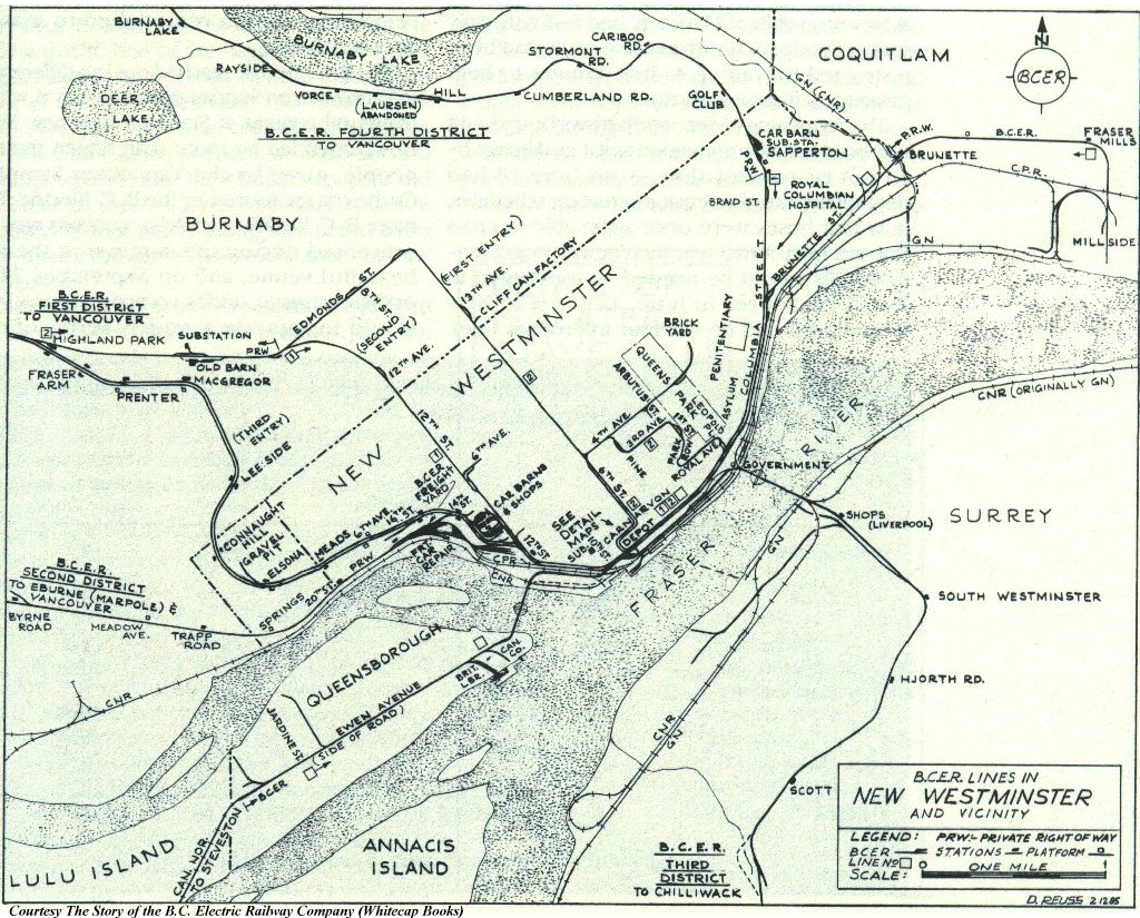
That's not to say that the entire rail infrastructure remains in use. Like in many - most - other places, rail started experiencing hard times from the 1950s on. Last weekend I followed one such hard-luck line, seemingly abandoned since the middle of last century, along Stewardson Way in New Westminster, paralelling the BC Parkway and the SkyTrain. I'm not sure, because the map I found is handmade and rather old, but I suspect this track may be a remnant of British Columbia Electric Railway streetcar operations - either that or it's an old CNR line.

If there's ever an apocalypse, this is what the surviving rail lines will look like afterward.

I, the copyright holder of this work, hereby release it into the public domain. This applies worldwide. In case this is not legally possible, I grant anyone the right to use this work for any purpose, without any conditions, unless such conditions are required by law.

Wednesday, September 1, 2010

Plain Trains and Automobiles

Sprawling problems can easily spring from narrow vision. Just look at the postwar history of North America; in the last seventy years, the United States and Canada have hitched their destinies firmly to the automobile. Despite recent rumblings to build new and expand existing mass transit systems, my own gut feeling is that the economic abyss we're staring into is going to lead to a maintenance of the status quo for as long as the slapheads in power can get away with it.

The good thing about speculation is that it doesn't cost any money - though, of course, that inevitably leads to good ideas not being followed up on because politicians quail at the cost or "safety concerns," like GO-ALRT of the 1980s or the original plans for the Los Angeles subway. But it gives us a platform from which to jump when these things do become possible, and transportation is one of the more important things we can speculate about.

Last week, the Union Pacific Railroad revealed an experimental convertible rail car, the trademarked AutoFlex, designed specifically to transport vehicles. It's modular inside and can vary between bi-level and tri-level in order to accommodate vehicles of varying sizes. Presumably, this will be used for freight transport, since that's pretty much the lifeblood of the North American railway network at this point - transporting vehicles from factories to points-of-sale may be cheaper and more efficient if done by rail rather than road.

I know there are people who believe that the railway's time is over, that it will never approach its former glory and that private cars are a far more efficient means of getting around. Personally, I don't have much truck with that sort of viewpoint. What North America really needs in the years ahead is a coordinated improvement of its transportation networks - not just, as we had in the twentieth century, a monomaniacal focus on the road network to the detriment of everything else. The idea behind Union Pacific's new car opens new possibilities for the road system and the rail network to work hand-in-glove.

Working in concert, they can be stronger than they ever could alone.

After decades of experimentation, speculation and anticipation, electric vehicles are at last starting to make headway in the automotive market. Most of them are hybrids, to be true, but pure electrics aren't totally unheard of - I even saw a Tesla Roadster on the road in Toronto a few weeks ago, and its utter silence likely would have been even more stunning if I hadn't been drunk at the time. As petroleum becomes more expensive, it's likely that electric vehicles will capture more and more of the market share.

The biggest problem with EVs right now, though, is range. You can't just dump in a new charge the way you can fill a tank with gasoline, though the "1920s radio" model, where a depleted battery is swapped out for a fully-charged one, is effective and used at Better Place recharge stations. Additionally, future EVs may have more in common with the Smartcar than the SUV - small may be in style in years to come, but small isn't necessarily advantageous for long-distance trips.

This is where the railway could come in. If you're of the mind to go from one end of the country to the other, but you want your car at both ends, you just drive it to the railway station, park it in one of the train's car berths, and relax as you ride the rails to your destination. Since the train doesn't have to worry about highway traffic - assuming passenger rail ever gets meaningful signal priority over freight - or finding a hotel at night, you may end up arriving at your destination rather earlier than you would have if you'd driven. Once the train does pull in, all that's left is for you to get back behind your wheel and pull out.

I'll admit there's stuff to be worked through, here. But this is the sort of thing we should be thinking about more. We can't expect to find our way into the future when we're only thinking about what's been done in the past.